

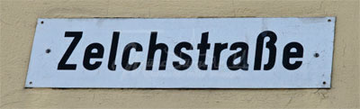
Zelchs
 Until the end of the 19th century farmers with their cattle teams formed the cityscape of Münchberg, but today there is not much to see of these city farmers. The farming was done mostly for their own use, but they were full time craftsmen. The rock cellars in the Kreuzberg Ravine are a relic of this time, but also this street name refers to it: Zelchstraße.
In a plan from 1852 these long field strips which are designated “Zelchs” are clearly visible. Already centuries before there were agricultural settlements at the river Pulschnitz. Originally the elongated plots lay in a line directly behind the houses. In the course of the years there were shifts of the land due to inheritance or sales. So the Zelchs didn’t later border directly on the buildings of the owners. In the area to the east of Bismarckstraße the Zelch fields stretched to the Eisteich (ice pond - today the sports facilities of the same name). The ancestors of the city farmers terraced the mountain fields along the contour lines, in order to make them more farmable. So there were field ridges, which made an approximate 1-meter difference in height between the Zelchs. In spite of the hillside, the fields were now relatively even and soil erosion was avoided.
Erwin Riedel, born in 1911, was one of the last city farmers. His ancestors were tanners and farmers. To their property in lower Ludwigstraße belonged a barn on the east side of Bismarckstraße. After that followed a grass garden and finally their Zelch over today’s Karlstraße to Ziegelweg.
Otto Pöhlmann was born in 1854 and was a beer brewer, maltster, baker and farmer. Next to the brewery his son Karl also ran the farming until is death in 1954. The Zelch, which belonged to the brewery at Ludwigstraße 6, began on the "Kegelschub" (bowling alley - Nützels Bräustübl) and ran over Karlstraße to present day Virchowstraße.
Below that lay the Holper Zelch, which began at “Scharfes Eck” ("sharp corner" of Bahnhofstraße/Bismarckstraße) and led directly from the Mönchsbräu in Zelchstraße to the eastern region to Eisteich (ice pond). So that the beer of the Münchberg breweries could be well cooled in the warehouses they pulled ice blocks out of ponds in the current sports grounds direction to Schlegel and provided it for example also in the rock cellars or in the "Eishaus" (ice house) in the Kreuzberg Ravine.
In the graphic below the Zelch of the just mention owners around 1900 are marked in color. The black and white map shows Münchberg around 1852 with the Zelchs from whose course the present streets such as Zelchstraße, Albert-Schweitzer-Straße, Otto-Kalbskopf-Straße, Virchowstraße and Schillerstraße originate. The current map of Münchberg with designations for these street names marked for comparison is underlaid as a background.

Video: Aerial view Zelchs
Copywriters, authors, photographers, rights holders or sources:
Rainer Fritsch, Sandy Schroeder, Helmut Baier, Klaus Schroll, Klaus Foerster, city archives
Audio file